- From
-
Published on
13.05.20
- Impact Area
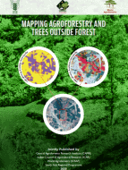
New Delhi, India, 13 May 2020 — A new book, Mapping agroforestry and trees outside forest, was launched on 4 May 2020 by Trilochan Mohapatra, secretary, Department of Agricultural Research and Education and director-general, Indian Council of Agricultural Research, Government of India during an online meeting with 12 CGIAR centres operating in India.
‘This publication compiles the joint efforts of ICAR’s Central Agroforestry Research Institute and ICRAF to harmonize terminologies, definitions and techniques used to map trees outside forests or agroforestry; and development of a geospatial methodology to map a particular agroforestry tree species,’ said Mohapatra. ‘The information provided in the book is easy to understand and implement by promoters of agroforestry’.
Related news
-

ICRISAT to Deliver World-Class Services as CGIAR’s Breeding Resources South Asia Hub
07.07.25-
Biodiversity
-
Food security
Strategic collaboration to scale innovation and deliver harmonized, high-quality support across CGIA…
Read more -
-

Multifunctional Landscapes that reconcile food production, with ecosystem restoration and biodiversity conservation
06.07.25-
Biodiversity
-
Environmental health & biodiversity
The CGIAR Multifunctional Landscapes Science Program (MFL SP) is driven by a bold vision of…
Read more -
-

Mapping for Resilience: How Spatial Data is Transforming Karamoja Cluster
02.07.25-
Climate adaptation & mitigation
Pastoral communities in the Karamoja Cluster (a region spanning Kenya, Uganda, South Sudan, and Ethi…
Read more -