-
From
CGIAR Initiative on Climate Resilience
-
Published on
15.05.24
- Impact Area
Authors: Benson Kenduiywo, Victor Korir, Livia Sagliocco, Victor Villa, and Anna Belli (Alliance of Bioversity and CIAT)
Climate change is widely recognized as one of the driving forces behind the surge in extreme weather events and human insecurities. For instance, the ongoing heavy rainfall in Kenya has caused significant damages to infrastructure, crops, and livestock, as well as to both lives and properties. Such extreme weather shocks disproportionately affect Arid and Semi-Arid Counties (ASACs) coming on the heels of 5 consecutive failed rainy seasons which had already caused significant losses of livestock and crops. Therefore, the ASACs have recognized the need to collectively find climate-resilient peace–sensitive solutions to address ongoing resource-based conflicts (e.g., water and pasture) that are continuously amplified by climate change, leading to a vicious cycle of increased tensions.
The ASACs face a range of environmental challenges that threaten the livelihoods of local communities and pose significant risks to human and community stability. These challenges include climate-related issues such as droughts, heat stress, extreme rains, and flooding, as well as land degradation, loss of biodiversity, inter-ethnic violence, cattle rustling, county border disputes, and land conflicts. Nonetheless, amidst these challenges, there is an opportunity for transformation and innovation.
The Alliance of Bioversity and CIAT (ABC) acknowledges the central role that science plays in addressing the multifaceted challenges posed by climate change. Therefore, ABC through the Climate Resilience initiative (ClimBeR), developed the Climate Security Observatory (CSO), an online decision support tool that collates research evidence on HOW climate is exacerbating root causes of conflict, WHERE it is happening, WHO is affected, and WHAT can be done to break the vicious cycle between climate and conflict and build resilience. To address the WHERE and WHO questions, ABC has identified climate security hotspots within 21 km2 grids as areas where conflict incidents, extreme climatic conditions, and socioeconomic vulnerabilities co-occur. These hotspots identify locations where multiple risks can arise and provide details of most vulnerable groups (i.e. women, children, the elderly), which provides valuable insights for policymakers and stakeholders for targeting interventions and prioritization.
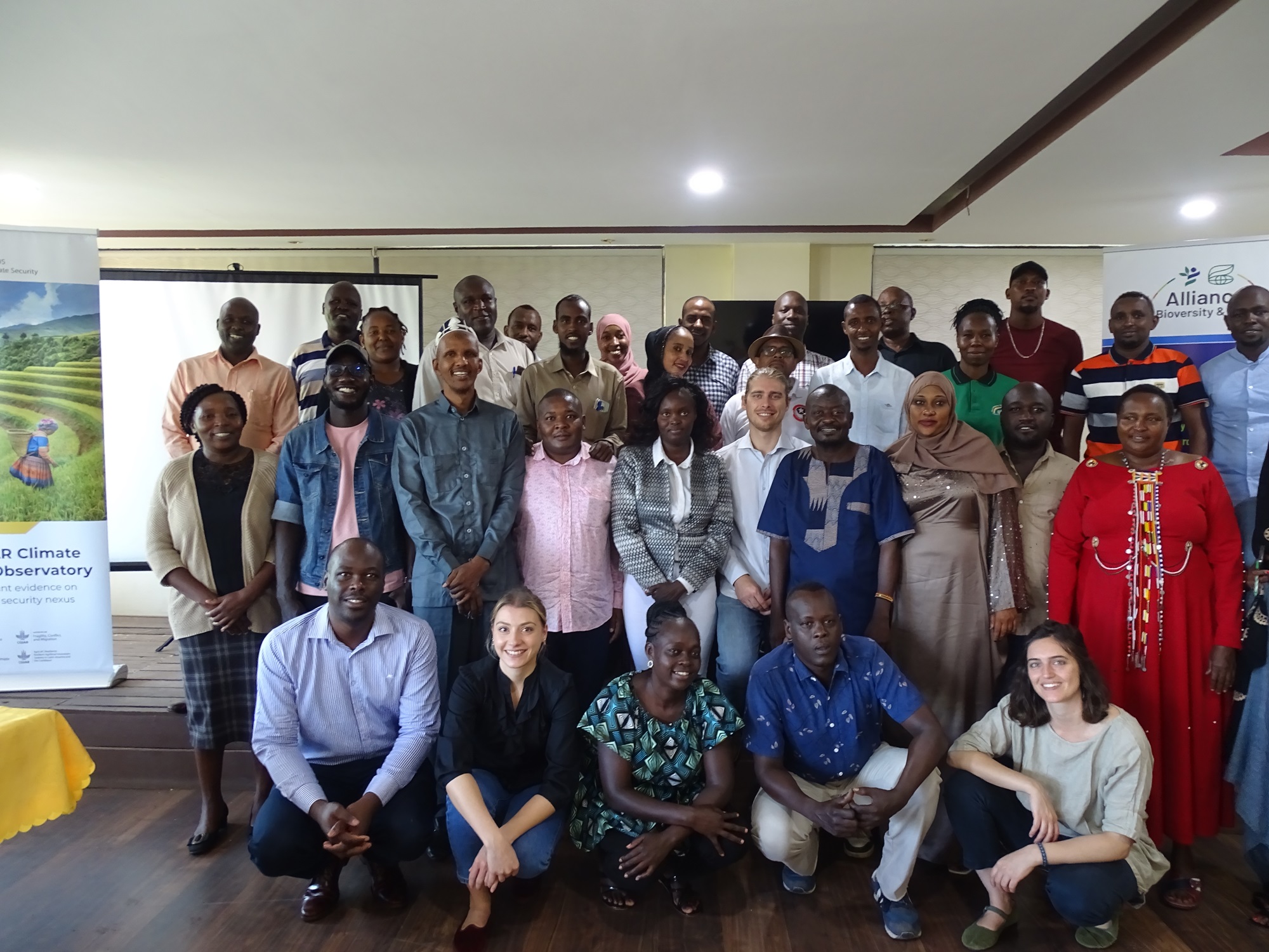
Consequently, ABC partnered with Humanitarian OpenStreetMap -Eastern & Southern Africa hub (ESA-Hub) through the Open Mapping grant program to organize a workshop in Isiolo between 22nd – 24th May 2024 with an objective to: (1) raise awareness around climate security issues, (2) present, validate and identify new climate security hotspots, and (3) catalyze local resilient solutions using participatory mapping. The activity included stakeholders drawn from the Ministry of Interior and National Administration, Civil Society Organizations, Indigenous People’s representatives, county departments of environment from Lamu, Tana River, Garissa, Wajir, Mandera, Marsabit, Isiolo, Turkana, Samburu, Laikipia and West Pokot ASACs. All of them were selected based on their contextual expertise as well as their involvement in climate security dynamics within and across the different regions.

Key discussions centered on the nature of both extreme climate events and conflict within the identified hotspots, both those uncovered by the CSO research and new ones identified by participants. Concerning climate shocks, the participants pinpointed the different climate extremes experienced, their frequency and subsequent cascading impacts on livelihoods. Conflict was also discussed in terms of its intensity, causes, frequency, and actors involved. The participants also mapped existing measures implemented to mitigate climate-related security risks and suggested new interventions.
In retrospect, participants identified new hotspots not captured through the CSO research due to limitation of open data on conflict. Cross cutting challenges highlighted in the ASACs included cattle rustling, overgrazing leading to land degradation, land rights disputes, displacement of people, water scarcity, unclear migration corridors, invasive species spread over grazing areas, and high illiteracy levels amongst others. Unique challenges also exist for instance, siltation of lake Turkana which leads to imbalanced fish availability causing conflict over fishing territories between beach management units and fisherfolks vs Kenya Wildlife Service in protected areas of the lake including insecurity triggers caused by Al Shabaab in Tana river and Lamu counties.

Over and above the challenges stakeholders identified solutions using participatory mapping that could leapfrog resilience and peace. Some of the proposals encompasses licensing and regulations over shared resources (e.g. lake Turkana and grazing areas), land-use planning, capacity building/awareness on climate change, land adjudication, promotion of indigenous drought resistant livestock and seeds, water harvesting in hotspot areas, value addition of farmers products through cooperatives, mobilizing funds to hotspots through green climate funds, digital peacebuilding targeting youths, and improved dissemination of early warning information. Eventually, the combination of hardcopy maps and digital tools for participatory mapping helped stakeholders highlight unique local challenges and reflect on best approaches to tackle them locally and at national level.
As next steps, the information collected will be collated and disseminated both at national and subnational level, collaborating with governmental authorities and community members. In the long term, these efforts aim to enhance climate resilience within communities through informed and data-driven interventions guided by participatory mapping. Empowering local communities and stakeholders to develop and sustain climate security solutions will promote local ownership and long-term sustainability. The initiative also builds on ABC’s influence policy recommendations, that it incorporated in Kenya’s National Climate Change Adaptation Plan (NCCAP) III, for spatially aware decision support systems to support decision-making at the national and local levels on climate security.

Furthermore, it will strengthen collaboration among government entities, NGOs, CSOs, and local communities, fostering a coordinated approach to climate security challenges. By building the capacities of stakeholders in utilizing open mapping tools and participatory approaches, the project ensures continued application beyond its lifespan. Increased awareness and advocacy for climate peace and security will leverage the project’s findings and methodologies to drive broader engagement and action in other regions.
Related news
-

Mapping for Resilience: How Spatial Data is Transforming Karamoja Cluster
02.07.25-
Climate adaptation & mitigation
Pastoral communities in the Karamoja Cluster (a region spanning Kenya, Uganda, South Sudan, and Ethi…
Read more -
-

Building Resilience and Regeneration: The Central Highlands Ecoregion Foodscape (CHEF)
02.07.25-
Climate adaptation & mitigation
At the CGIAR Sustainable Farming Program (SFP), we believe that collaboration is essential for trans…
Read more -
-

Planting with Precision: How Weather and Climate Information is Changing Bean Farming in Rwanda
01.07.25-
Climate adaptation & mitigation
Imagine weather information as a GPS for farmers. Without it, the journey becomes uncertain, filled…
Read more -